Daily Beach Flights
Coastal Surveillance Flights for Floatable Debris and Remote Sensing for Algal Blooms

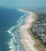
Coastal surveillance flights are conducted six days a week during the summer season, weather permitting, in order to get a visual assessment of coastal water and beach conditions. This aerial surveillance of the coast and bathing beaches allows DEP to determine the extent of potential hazards such as floatable debris, sewer line breaks or fish kills. In addition, the aircraft are equipped with chlorophyll a sensors that provide DEP with information on chlorophyll levels in coastal waters and allow the early detection of potential algal blooms. Increased chlorophyll a levels are not necessarily harmful to human health but can give the Bureau information on where to target more intensive boat sampling. Click here to view coastal flight paths and chlorophyll a information.
Lakes Surveillance Flights with Remote Sensing for Algal Blooms
One day a week, generally on Tuesdays, the plane flies over select NJ lakes conducting aircraft remote sensing using phycocyanin measurements for estimating the presence of cyanobacteria Harmful Algal Blooms (HABs). Phycocyanin measurements are used to estimate the cell density and the spatial extent of cyanobacteria. This information is used by DEP to strategically deploy staff to collect HAB samples for laboratory analysis. Laboratory analysis of cell density, species and cyanotoxins are used to confirm the presence of HABs and to determine if a recreational Alert level is triggered. Click here to view lakes flight paths and cyanobacteria information.


![[Banner] [Banner]](/njdep_common_files/images/beachbannernofade.png)


